Wherever that might take me…
Saturday, February 16, 2019, 6:48 am, the still unlicensed white Jeep pulled away from Lake Havasu City, Arizona into the barren Nevada desert.
When I left LHC, I briefly left AZ, entered into California, then Nevada, somehow came back to Arizona then hit Utah! and finally Colorado. (Yes, I know Utah! changed their license plate a while back, but I still can’t say or type Utah! without the exclamation point. What can I say, it stuck.)
Another side note, I wasn’t lost right up there ^, I simply got on Highway 95 and headed north which took me slightly west, north, west again, then north east. Hey, sometimes there’s a reason I travel solo.
I put in between 13-14 hours of drive time that day and made plenty of stops for roadside Joshua Trees in the Nevada back country, potty breaks where the palm trees met the mountains & slot machines, and a little bit of photography where that fluffy white stuff started resurfacing on the sides of the road in Utah!
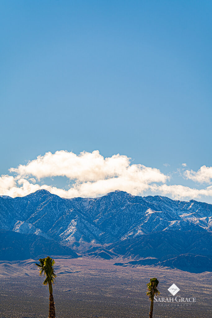
After saying my second goodbye to Arizona, I entered a city that looked like it was straight out of a movie scene. This was the stunning town of St. George, UT, where I can still visualize the white capped red mountain tops against a city lit by the mid-day light. There stood a sharply contrasting steeple of the massive white St. George Temple against the rugged and vibrant dusty red bluffs peaked with snow-capped summits behind.
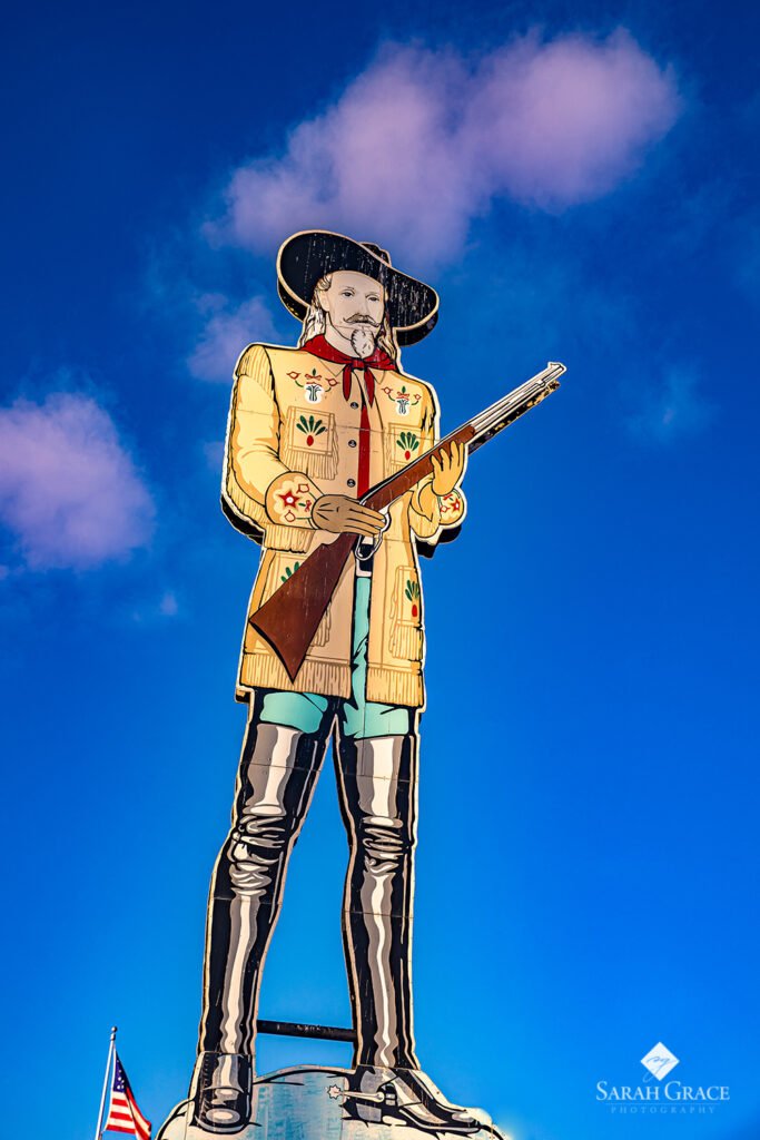
The Red Cliffs National Conservation Area, Zion National Park, MOAB/Arches and Bryce Canyon Nation Park were all within reach on this tour leg. However, due to several winter storm fronts that traveled across the nation in February, I was smack dab in the middle of two of them. This saddened my free-spirited as I know there are some earth-shattering imagery at these parks.
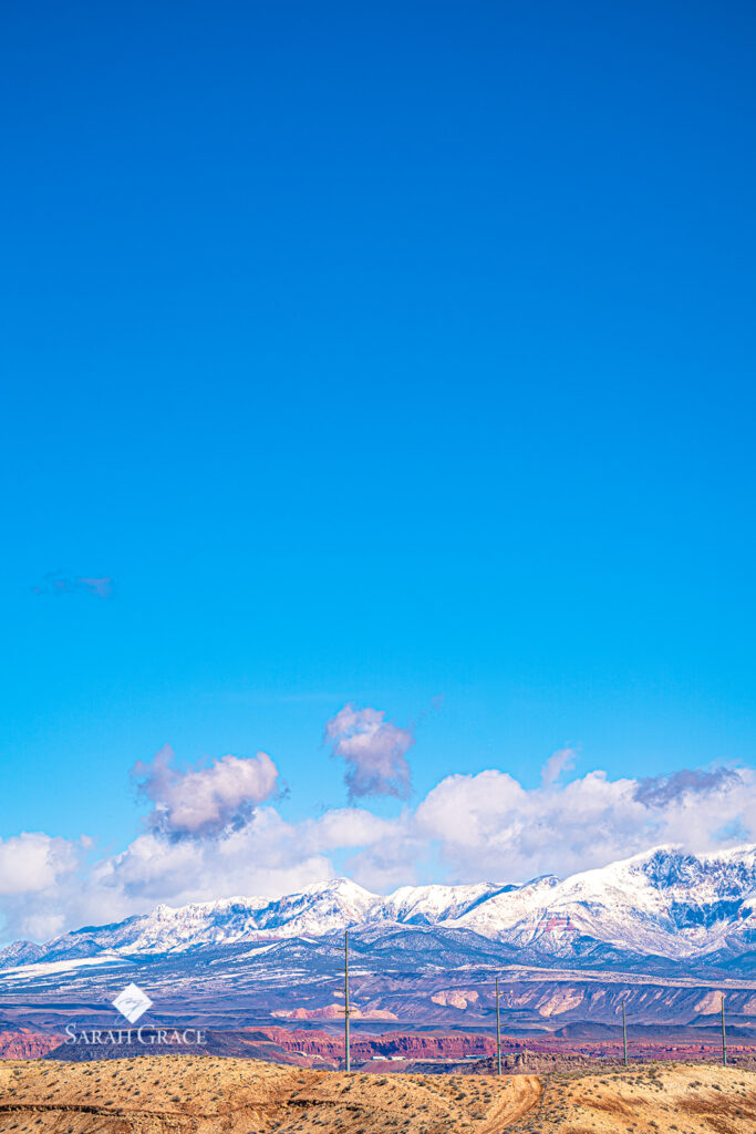
Traveling at elevations of 2,300 – 7,200 feet, I hit several pockets of light snow showers. While asking for the best meal in town at the gas station, I stopped at Charlie’s Southern BBQ nestled in Cedar City, UT, where the pulled pork, topped with slaw, was the best thing I’d tasted since my Texas shaped waffle.
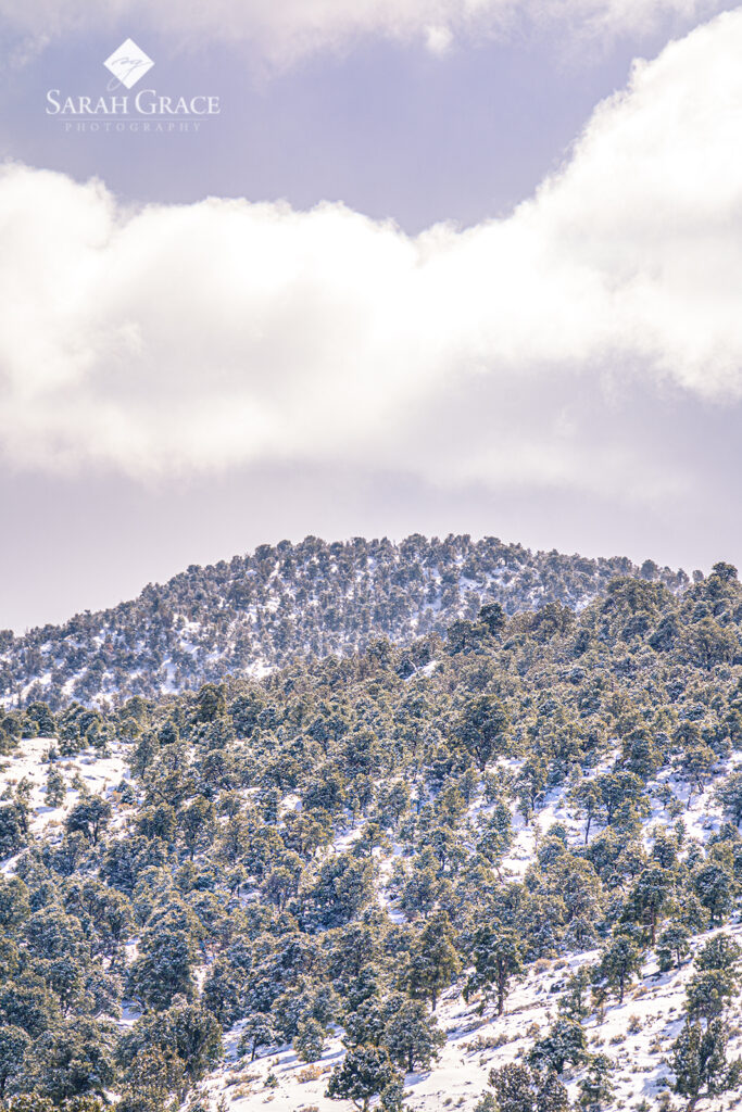
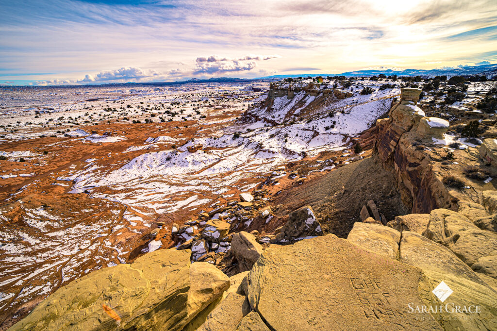
After my other tank was filled, I drove for a very long time in the plains valley between two mountain ranges. On the eastern side of Utah!, I stopped to see the San Rafael Swell, which I like to call Utah’s version of the Grand Canyon. So many layers of earth exposed from thousands of years ago. Quite breathtaking – even if there was a layer of that white stuff on top.
I tried making it just north or south of Denver to stay with family or friends, but I was getting so tired that I knew I couldn’t drive straight thru, even if it was just a couple more hours. So Grand Junction, Colorado it was for the evening.
I found a great little restaurant, Spoons Bistro & Bakery, where I had a delicious meal, a bit of red wine and went back to the hotel and crashed after a long day of driving. I feel asleep quickly and that’s when it all started happening.
It was early morning, I had gotten a good night sleep & was fresh and ready to go. My drive started out on a windy two lane road right next to the mountainside, like most roads in the foothill towns. For the past two days, I had been seeing signs & slopes covered with wire mesh warning drivers to watch for falling rock. Right then, I saw a boulder, not just a rock, a full size, 8 ton boulder, fall on the road, right in front of the hood of my white Jeep!
That’s when my eyes flew open & I checked my pulse to make sure I was still alive. Clearly, in my subconscious mind, I was worried about falling rocks while driving, but did it really have to flash my life in front of me in my dream!
As I set out, on a foothills road that looked a little familiar, I drove between slow & fast. Is it worse to not see the boulder coming, or to drive slow to try to estimate where it might land… “driving thoughts” by Sarah Grace.
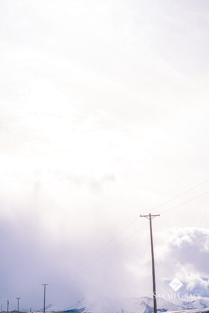
I recall stopping at a grocery store to grab breakfast (hard-boiled egg, green juice, maybe an apple), & walking out to the vehicle only to see the bright sunny day turn a wee bit wicked. Approaching was a threatening, thick line of gray storm clouds that were taking over the mountain peaks, right where I needed to go, to get over the pass.
Luckily, I only encountered a brief moment of terror as it began to snow, then sleet, then snow again. I was making my way along the Green River which was inexplicably astonishing with steam coming off the water. However, the 5-10 degrees above zero, poor road conditions & zero shoulder or exits made it impossible to stop, look around or sight-see in any manner.
When I thought the white knuckle driving was over, that’s when I hit Avon & Veil, CO. After being so far in the canyon floor & losing cell signal with family, I was now over 9,000 feet elevation & it was ICY. To add some humor into the mix, it started to flurry. Our two lanes of traffic heading down a 6% grade mountainside turned to one & I have never been so scared of using my brakes as I was then.
There was an accident ahead & I stopped off in Veil to grab some protein to keep my mind sharp. It was evident that this area had just been pounded with at least 4 feet of snow the day before. For such gorgeous landscape, I was terrified of being there, ever again, in the winter. Mentally & physically, I was ready for a break.
Once I hit Denver, I got it, nothing but sunshine and brown earth, no mountain passes to climb or storm clouds to drive through. There was a long stretch of road on open fields where the wind gusts were enough to blow this 132 lb. chica flat.
I learned that there are many correctional facilities in eastern Colorado & that I shouldn’t pick up hitch-hikers. Bummer, they have the best stories. While chatting with my navigators, my parents, we decided that it was best for me to head north to South Dakota to avoid Storm Nadia’s snow dumping in Iowa & Omaha.
Highway 83 North to Valentine, Nebraska was my destination that night. It was dark, getting late, & temps were hovering in the single digits with wind gusts of 20 mph. The hilly two lane back road was devoid of any specks of life on the side of the highway, maybe a driveway to a ranch once every 17 miles or so.
Then, the landscape changed from small hills to foothills once again, & the flurried started up. I could tell the roads were slick from the blowing winds & simply tried to keep the wheels pointed straight as semi-trucks passed in the opposite lane creating a vortex that sucked the Jeep in & just as quickly pushed it back out with the velocity of a comet.
The white knuckling & turtle-like pace ended once I finally pulled into a sweet little town called Valentine. I pulled up the Hotel Tonight app as I was sitting in a vacant grocery store parking lot. When I was about to pick the best of the not so attractive, I looked up & saw a savior lit up like Santa’s workshop across the street.
She was The Niobrara Lodge & it was a stately looking lodge that spoke homey & comfortable yet convenient & soothing. A friendly beacon in the middle of literally nowhere. With a good soak in the hot tub & a bed that was way to comfortable to go unnoticed, I swiftly fell asleep, soundly this time.
“Wrong Turn?”
In the morning, I realized what a unique landscape I was in & told myself I would come back with the rest of the family during the warmer months. Waterfalls, rivers, Cowboy Trail, National Parks, & sand hills make this area a gem.
As I entered South Dakota, I immediately spotted a familiar site that I no choice but to visit … it was Caribou Coffee. Flying across I-90, I found that the speed limit was still a bit to risky for the blowing wind and negative windchill. Oh, did I forget to mention it is still February?
I hit the home stretch & finally entered Minnesota through a small town called Luverne. Thanks to the Minnesota tourism board, I discovered that my idol, National Geographic Photographer, Jim Brandenburg, grew up & had a gallery in Luverne! Of course I stopped. Silly question. Of course I purchased a print of a weeping willow in the spring in the middle of a shallow pond.
Even better yet, all of the proceeds from the sales of this amazing gallery go to preserve the prairie-lands in Luverne. Double bonus.
My journey was in the final leg & there was one thing I had realized on this long & beautiful excursion: I have the option to drive up to 80 mph through the highest snow-covered elevations our land has to offer, but fear not, when I pull into Minnesota, one of the flattest states in the nation, I get the opportunity to travel 55 mph, one of the slowest speed limits in the country.
Until our next adventure, be safe, be aware, & speed every once in a while. 😉